About the profile
Mobile robots and other vehicles equipped with sensors to perceive their surroundings are impacting numerous applications. This ranges from autonomous cars and logistics tasks, over agricultural robots operating autonomously on our fields, to robots performing inspections or executing mobile manipulation tasks.
The profile "Mobile Sensing and Robotics" in the University of Bonn's Geodetic Engineering MSc program teaches you to understand and program such systems.
Your interests
- multi-sensor systeme
- smart farming
- UAV,
- self-driving cars
Your background
- solid foundations in mathematics
- solid foundations programming
- highly motivated to acquire new skills for setting up your own research projects
Programming
Programming is a basic skill needed to solve tasks and complete homework assignments and thus is essential to thriving within the profile of Mobile Sensing and Robotics. The majority of courses, especially all mandatory ones, require Python skills. An elective course will provide an introduction to C++ and its usage in programming robots.
If you have not worked with Python so far, we highly recommend to study it before arrival using our "Python Basics Playlist".
Features of the profile
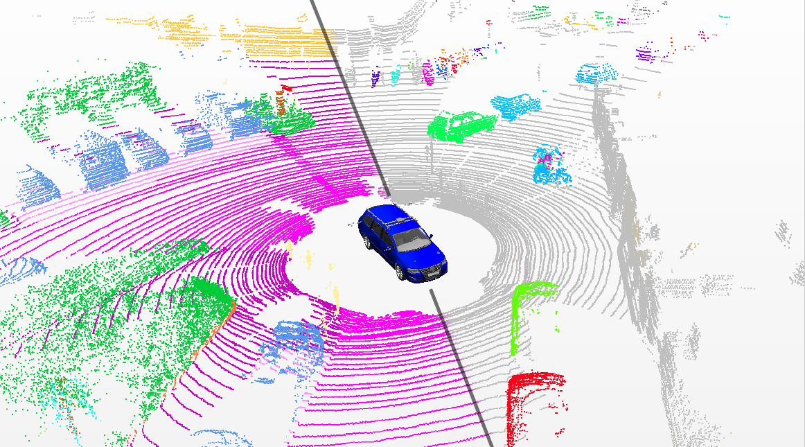
The course program addresses state-of-the-art techniques for analyzing and interpreting sensor data and turning it into appropriate models. As a student in this profile, you will become familiar with complex multi-sensor systems. It involves combining different types of sensors like laser scanners, cameras, GNSS receivers, or inertial sensors. You will learn to implement algorithms to calibrate such sensors, use and analyze their data, and fuse different sensor data to estimate the vehicle's pose and the surrounding objects. Methods for kinematic pose estimation and pattern recognition and their use for interpreting image and laser data are key skills.
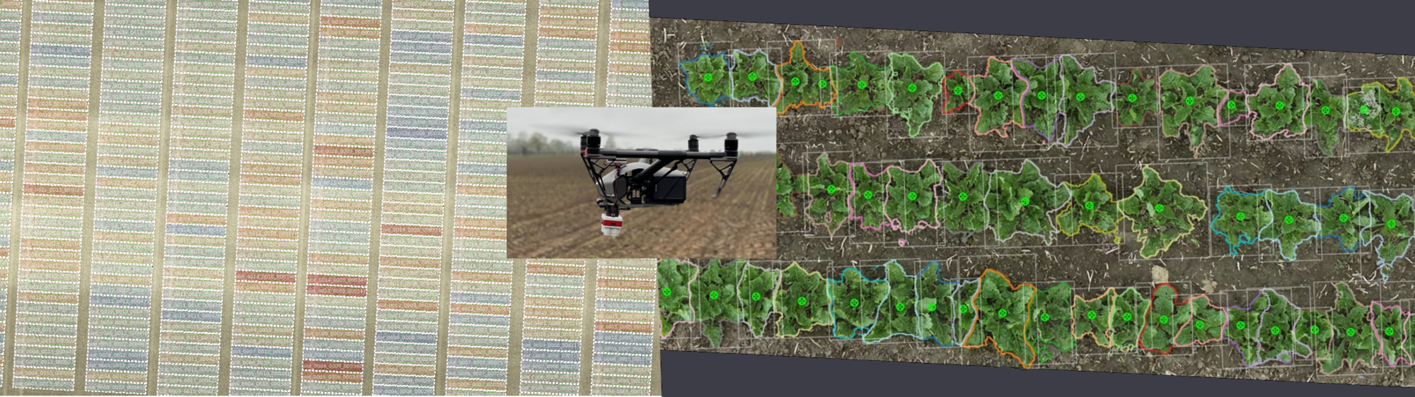
Besides numerous application areas, the faculty explicitly offers a unique opportunity for collaborating on smart-farming problems and innovative technologies for sustainable development. The study program will provide you with expertise in solution-oriented approaches, which are theoretically founded and on the frontier of current research activities. You will also learn skills in project management, teamwork, and the presentation of your work.
Outlook
The profile aims to provide students with the expertise and capabilities required to work in academia, research institutions, and robotics or geodetic technology companies. Courses are taught by internationally renowned experts in engineering geodesy, robotics, photogrammetry, and data analysis.
Lecturer in the Profile
Mobile Sensing
Prof. Dr. Lasse Klingbeil
0.013
Nußallee 17
53115 Bonn
Geodesy
Heiner Kuhlmann
1.010
Nußallee 17
53115 Bonn
Photogrammetry
Prof. Dr. rer. nat. Cyrill Stachniss
Nußallee 15
53115 Bonn